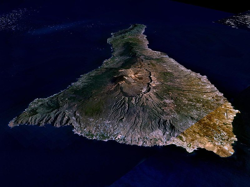
Soubor:Nasa world wind - teneriffa.jpg
Skočit na navigaci
Skočit na vyhledávání

Velikost tohoto náhledu: 800 × 599 pixelů. Jiná rozlišení: 320 × 240 pixelů | 640 × 479 pixelů | 1 024 × 766 pixelů | 1 280 × 958 pixelů.
Původní soubor (1 280 × 958 pixelů, velikost souboru: 120 KB, MIME typ: image/jpeg)
Historie souboru
Kliknutím na datum a čas se zobrazí tehdejší verze souboru.
| Datum a čas | Náhled | Rozměry | Uživatel | Komentář | |
|---|---|---|---|---|---|
| současná | 31. 3. 2005, 03:15 |  | 1 280 × 958 (120 KB) | Simplicius | {{NASA-PD}} Teneriffa from the west side. One sees Teide (3,700 meters) and the Caldera (2,000 m). To the right hand the new airport. On the left side one sees that there is more humidity and therefore vegetation at the north side of the island. |
Využití souboru
Tento soubor nepoužívá žádná stránka.
Globální využití souboru
Tento soubor využívají následující wiki:
- Využití na ar.wikipedia.org
- Využití na be-tarask.wikipedia.org
- Využití na cs.wikipedia.org
- Využití na de.wikipedia.org
- Využití na de.wikinews.org
- Využití na de.wikivoyage.org
- Využití na en.wiktionary.org
- Využití na eo.wikipedia.org
- Využití na es.wikipedia.org
- Využití na fa.wikipedia.org
- Využití na fi.wikipedia.org
- Využití na frr.wikipedia.org
- Využití na fy.wikipedia.org
- Využití na gl.wikipedia.org
- Využití na he.wikipedia.org
- Využití na hu.wikipedia.org
- Využití na incubator.wikimedia.org
- Využití na it.wikipedia.org
- Využití na mn.wikipedia.org
- Využití na nn.wikipedia.org
- Využití na no.wikipedia.org
- Využití na pl.wiktionary.org
- Využití na ru.wikipedia.org
- Využití na sh.wikipedia.org
- Využití na sk.wikipedia.org
- Využití na sw.wikipedia.org
- Využití na tr.wikipedia.org
- Využití na uk.wikipedia.org
- Využití na vi.wikivoyage.org
- Využití na zgh.wikipedia.org
